
The Deepwater Horizon oil spill, triggered by an explosion on the BP-operated drilling rig, was one of the largest environmental disasters in U.S. history. It resulted in a massive release of oil into the Gulf of Mexico, affecting marine and coastal ecosystems, wildlife, and local economies.
Posted to their official Flikr page, The United States Geographical Survey posted this fantastic photo album dedicated to their response to the disaster. It not only showcases the immediate actions taken to mitigate the disaster but also illustrates the comprehensive scientific efforts to understand and address its long-term impacts.
USGS Actions Following Deepwater Horizon
Disaster Response and Mitigation:
The images capture the immediate response efforts to contain and clean up the oil spill. This includes deploying boom barriers to prevent the spread of oil, using skimmers to collect the surface oil, and applying dispersants to break down the oil in the water.
Environmental Impact Assessment:
Several photos show USGS scientists collecting samples and conducting field studies to assess the impact of the oil spill on water quality, sediment, and coastal habitats. These assessments were critical in understanding the short- and long-term effects of the spill on the environment.
Wildlife and Habitat Protection:
The album also highlights efforts to protect and rehabilitate wildlife affected by the spill. There are images of wildlife recovery operations and the use of protective measures to safeguard fragile coastal and marine habitats.
Scientific and Technological Contributions:
Various scientific and technological approaches used in the response are documented, including aerial surveys, satellite imaging, and geospatial analysis to monitor the extent of the spill and its movement. These tools helped guide response strategies and evaluate the spill's impact on the Gulf's ecosystems.
Community and Collaborative Efforts:
The response to the Deepwater Horizon spill involved a collaborative effort among federal, state, and local agencies, as well as private organizations. The album features images of coordinated efforts and meetings among different stakeholders working together to address the crisis. Samples from the oil spill were collected by Louisiana USGS scientists Greg Swayze and Charlie Demas and sent for analysis in Menlo Park, CA.
The Role of Sampling, Preparation and LC Analysis
Sample Collection
- The album features images of scientists collecting various types of samples from the affected areas, including water, sediment, and biological specimens. These samples were crucial for analyzing the presence and concentration of oil and its by-products.
- Pictures depict the careful extraction and handling of these samples to maintain their integrity and prevent contamination, a vital step in ensuring the accuracy of subsequent laboratory analyses (U.S. Department of the Interior) (NOAA NCEI).
Transportation to Laboratories
- Once collected, samples were transported under controlled conditions to various laboratories for detailed analysis. The images show secure packaging and labeling of samples, which is essential for tracking and maintaining the chain of custody from the field to the lab (USGS Water).
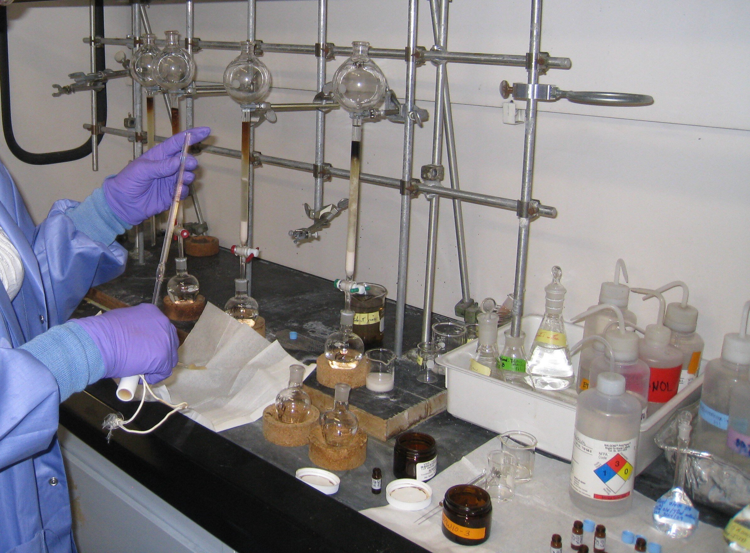
Sample Prep and Analysis Through Liquid Chromatography
1. Chemical Analysis:
- The laboratory images display the use of sophisticated analytical techniques to identify and quantify the chemical composition of the samples. Methods such as liquid chromatography-mass spectrometry (LC-MS) were employed to detect and measure hydrocarbons and other oil-related compounds in water and sediment samples.
- The samples were run through a liquid chromatograph column in order to separate the compounds of the petroleum. Following the preliminary separation, the dissolved samples are placed in a nitrogen evaporator. The nitrogen evaporator carefully evaporates only the solvent, leaving the separated samples behind. The nitrogen environment used by the evaporator ensures that the volatile compounds of the tar ball sample do not evaporate themselves.
- As pictured below, the USGS utilized an Organomation N-EVAP blow down dry evaporator. Dry baths are typically preferred by chemists looking to heat at higher temperatures than the water bath can provide, all the way up to 130 degrees!

- These analyses helped determine the extent of contamination and the chemical fingerprint of the oil, which is crucial for source identification and impact assessment (USGS Water).
2. Toxicity Testing:
- Some photos highlight toxicity testing procedures where samples are tested for their effects on marine life. This involves exposing organisms like fish and invertebrates to water samples and observing any adverse effects. These tests help evaluate the ecological impact of the spill and the effectiveness of dispersants used in cleanup operations (NOAA NCEI).
3. Microbiological Studies:
- Images also show microbiological analyses being conducted to study the response of microbial communities to the oil spill. Researchers examined changes in microbial diversity and activity, which play a crucial role in the natural biodegradation of oil in marine environments.
- Understanding how microorganisms break down oil components can inform bioremediation strategies and long-term environmental recovery efforts.
Data Management and Reporting
4. Data Analysis and Reporting:
- The album includes pictures of scientists working with data analysis software and preparing reports. This step involves compiling and interpreting laboratory results to create comprehensive assessments of the spill’s impact on the Gulf ecosystem.
- Accurate data management and reporting are essential for informing response strategies and policy decisions regarding environmental protection and restoration efforts (USGS Water).
5. Collaboration and Coordination:
- Many laboratory activities were conducted in collaboration with other federal and state agencies, universities, and research institutions. The images illustrate the cooperative efforts and information sharing among different entities working towards a common goal of understanding and mitigating the spill’s impact (U.S. Department of the Interior) (NOAA NCEI).